Trail Maps
Maps of Whistler
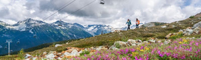
Whistler and Blackcomb are two side-by-side mountains which offer over 200 marked runs, 8,171 acres of terrain, 16 alpine bowls, and 3 glaciers combined. In the summer, Whistler Blackcomb offers a variety of activities including hiking and biking trails, the Whistler Mountain Bike Park, and sightseeing on the PEAK 2 PEAK Gondola.
Winter Trail Map
, opens in a new window
Download the PDF version of the Whistler Blackcomb Trail Map.
View our TRAIL MAP MOBILE VERSION
New EpicMix Time Features Lift Line Forecasts
, opens in a new window
Coming this season, EpicMix Time will display forecasts of lift line wait times allowing you to find the lifts with the shortest wait times throughout the day. But that's not all. EpicMix also gives you:
Bike Park Trail Maps
Explore all riding zones and every trail in the bike park with our Trail Map.
Knowing which trail you should ride next for your ability has now been made clear with the Trail Progression Scale. This Orientation Guide separates technical and freeride trails and list them from Beginner to Pro Line in the correct order of their difficulty.
Village Maps
, opens in a new window
ALPINE HIKING TRAIL MAP
, opens in a new window
With two distinct alpine zones, over 50 kilometres of trails, and endless views and scenery, our world-class alpine trail network is an essential part of the PEAK 2 PEAK 360 experience. Both Whistler and Blackcomb Mountain offer signature hiking experiences. Download our trail map to discover which one you'd like to explore first.
Trailforks interactive trail maps
, opens in a new window
We have teamed up with Trailforks to bring digital interactive mapping to Summer at Whistler Blackcomb. On your personal device, you can view your live location, track your hike and plan where to go next. Plan your routes, check trail status and conditions or compare your trail times on the leaderboards. Whistler Blackcomb trail maps are free to view for all users. Download the free Trailforks app or visit Trailforks.com